Mapping of Natural Radon and Gamma Emissions
Our environment is marked by the presence of numerous toxic substances, pollutants, and contaminants—whether of natural or anthropogenic origin—which have been widely documented in recent years. This is particularly true for radioactivity, whether natural, naturally modified or enhanced by human activities (e.g., mining, geothermal energy), or artificial. However, human exposure to these hazards is often poorly understood due to a lack of precise data on the intensity, modes, and duration of exposure. In mainland France, the "average" individual is primarily exposed to the inhalation of radon decay products (32% of total exposure) and to external radiation, whether terrestrial or cosmic (accounting for 14% and 7% respectively). These two sources together represent more than 50% of the average exposure in France (medical exposure accounts for 35%, dietary sources 12%).
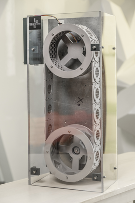
The radon and gamma radiation flux sensors developed under the TERRA FORMA project are a continuation of instrumentation research led by the LPCA (Clermont Auvergne Physics Laboratory), which resulted in the design of early prototypes. The aim is to develop sensors specifically intended to be worn continuously by volunteer individuals in order to obtain a fine-scale measurement of their exposure. These sensors will be geolocatable, highly portable, autonomous, and feature an easy interface for data retrieval.
The measurement of radon has a long history marked by numerous instrumental developments reflecting the scientific and health interest in this gas. In recent years, radon metrology using passive or active sensors has progressed significantly with the implementation of regulations on radon risk assessment in Public Access Buildings and the transposition of Directive Euratom 2013/59. However, the low-cost active sensors developed by major manufacturers are primarily designed for static measurements in confined indoor spaces (homes, public facilities, etc.) and do not allow for recording rapid fluctuations (<15 minutes) or geolocating the measurements. The goal is therefore to develop an active sensor capable of measuring rapid fluctuations in airborne radon concentrations (10–15 minutes), targeting concentrations ranging from 100 Bq/m³ to 1000 Bq/m³.
Many field tools for gamma radiation detection were initially developed for mining prospecting and thus intended for professional use. Following the Fukushima accident, citizen science initiatives (e.g., SAFECAST, OpenRadiation) based on geolocated gamma radiation measurements enabled the creation of participatory mapping. However, the tools used (Geiger counters) have limitations (strong sensitivity to orientation, need for numerous repeated measurements), making reliable mapping of rural or sparsely populated areas challenging. The proposed development aims to adapt a more accurate detector by integrating simple communication capabilities and data retrieval systems.
These sensors will support or enhance citizen science approaches and help transform volunteer participants into active contributors to research on environmental toxins, pollutants, and contaminants.
Theme : Biodiversity, Pollution

- Baskaran. 2016. Radon Measurement Techniques in Radon : A Tracer for Geological, Geophysical and Geochemical Studies. DOI
Updated on 23 juin 2025


